Union Extent or SpatialPolygons* objects
union.RdExtent objects: Objects are combined into their union. See crop and extend to union a Raster object with an Extent object.
Two SpatialPolygons* objects. Overlapping polygons (between layers, not within layers) are intersected, other spatial objects are appended. Tabular attributes are joined. See bind if you want to combine polygons without intersection.
Single SpatialPolygons* object. Overlapping polygons are intersected. Original attributes are lost. New attributes allow for determining how many, and which, polygons overlapped.
Union for SpatialLines and SpatialPoints simply combines the two data sets; without any geometric intersections. This is equivalent to bind.
# S4 method for class 'Extent,Extent'
union(x, y)

# S4 method for class 'SpatialPolygons,SpatialPolygons'
union(x, y)

# S4 method for class 'SpatialPolygons,missing'
union(x, y)

# S4 method for class 'SpatialLines,SpatialLines'
union(x, y)

# S4 method for class 'SpatialPoints,SpatialPoints'
union(x, y)Value
Extent or SpatialPolygons object
See also
merge for merging a data.frame with attributes of Spatial objects
and +,SpatialPolygons,SpatialPolygons-method for an algebraic notation
Examples
e1 <- extent(-10, 10, -20, 20)
e2 <- extent(0, 20, -40, 5)
union(e1, e2)
#> class : Extent
#> xmin : -10
#> xmax : 20
#> ymin : -40
#> ymax : 20
#SpatialPolygons
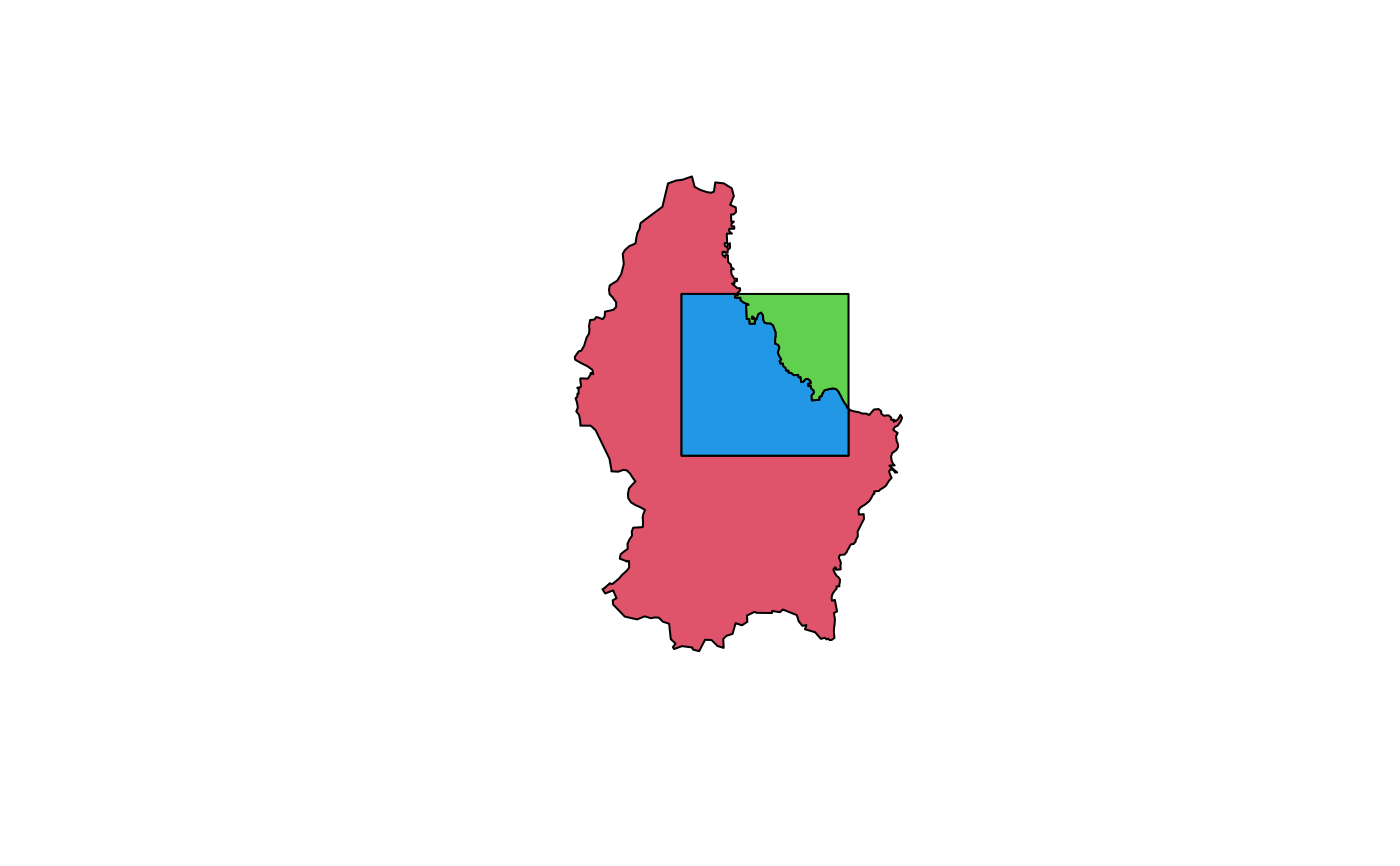
p <- shapefile(system.file("external/lux.shp", package="raster"))
p0 <- aggregate(p)
b <- as(extent(6, 6.4, 49.75, 50), 'SpatialPolygons')
crs(b) <- crs(p)
u <- union(p0, b)
plot(u, col=2:4)