Add additional nodes to lines or polygons
densify.RdAdd additional nodes to lines or polygons. This can be useful to do prior to using project such that the path does not change too much.
Arguments
- x
SpatVector
- interval
positive number, specifying the desired minimum distance between nodes. The unit is meter for lonlat data, and in the linear unit of the crs for planar data
- equalize
logical. If
TRUE, new nodes are spread at equal intervals between old nodes- flat
logical. If
TRUE, the earth's curvature is ignored for lonlat data, and the distance unit is degrees, not meter
Examples
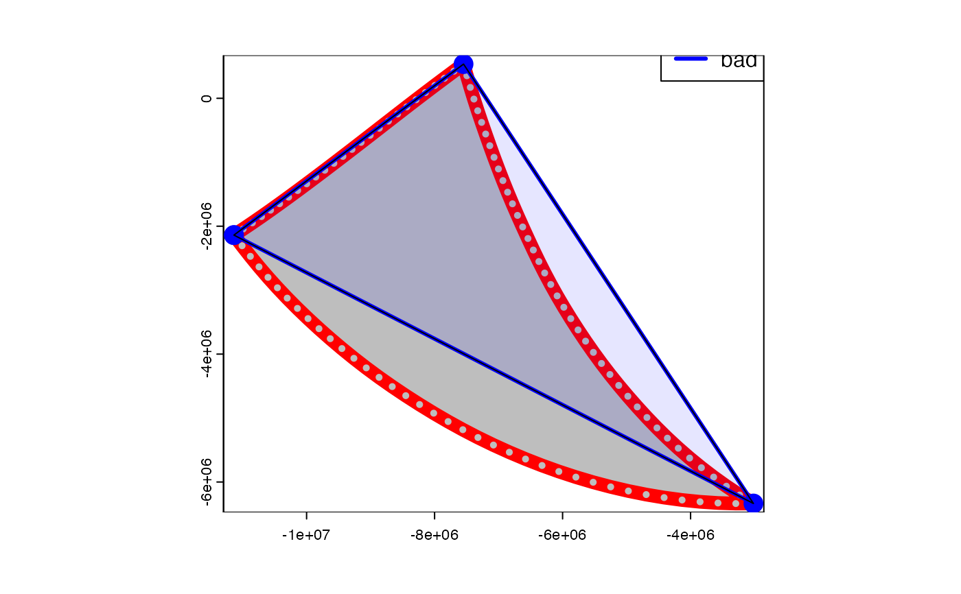
v <- vect(rbind(c(-120,-20), c(-80,5), c(-40,-60), c(-120,-20)),
  type="polygons", crs="+proj=longlat")
vd <- densify(v, 200000)

p <- project(v, "+proj=robin")
pd <- project(vd, "+proj=robin")

# good
plot(pd, col="gray", border="red", lwd=10)
points(pd, col="gray")

# bad
lines(p, col="blue", lwd=3)
points(p, col="blue", cex=2)
plot(p, col="blue", alpha=.1, add=TRUE)
legend("topright", c("good", "bad"), col=c("red", "blue"), lty=1, lwd=3)


## the other way around does not work
## unless the original data was truly planar (e.g. derived from a map)
x <- densify(p, 250000)
y <- project(x, "+proj=longlat")
# bad
plot(y)
# good
lines(vd, col="red")
## the other way around does not work
## unless the original data was truly planar (e.g. derived from a map)
x <- densify(p, 250000)
y <- project(x, "+proj=longlat")
# bad
plot(y)
# good
lines(vd, col="red")